GPS'CU
GPS'CU shows where your company's vehicles are and what they have done: the position on the map, routes, stops, reports and alerts. Teltonika trackers send the data straight to the platform, and for RO e-Transport the positions go to ANAF automatically while the UIT is active.
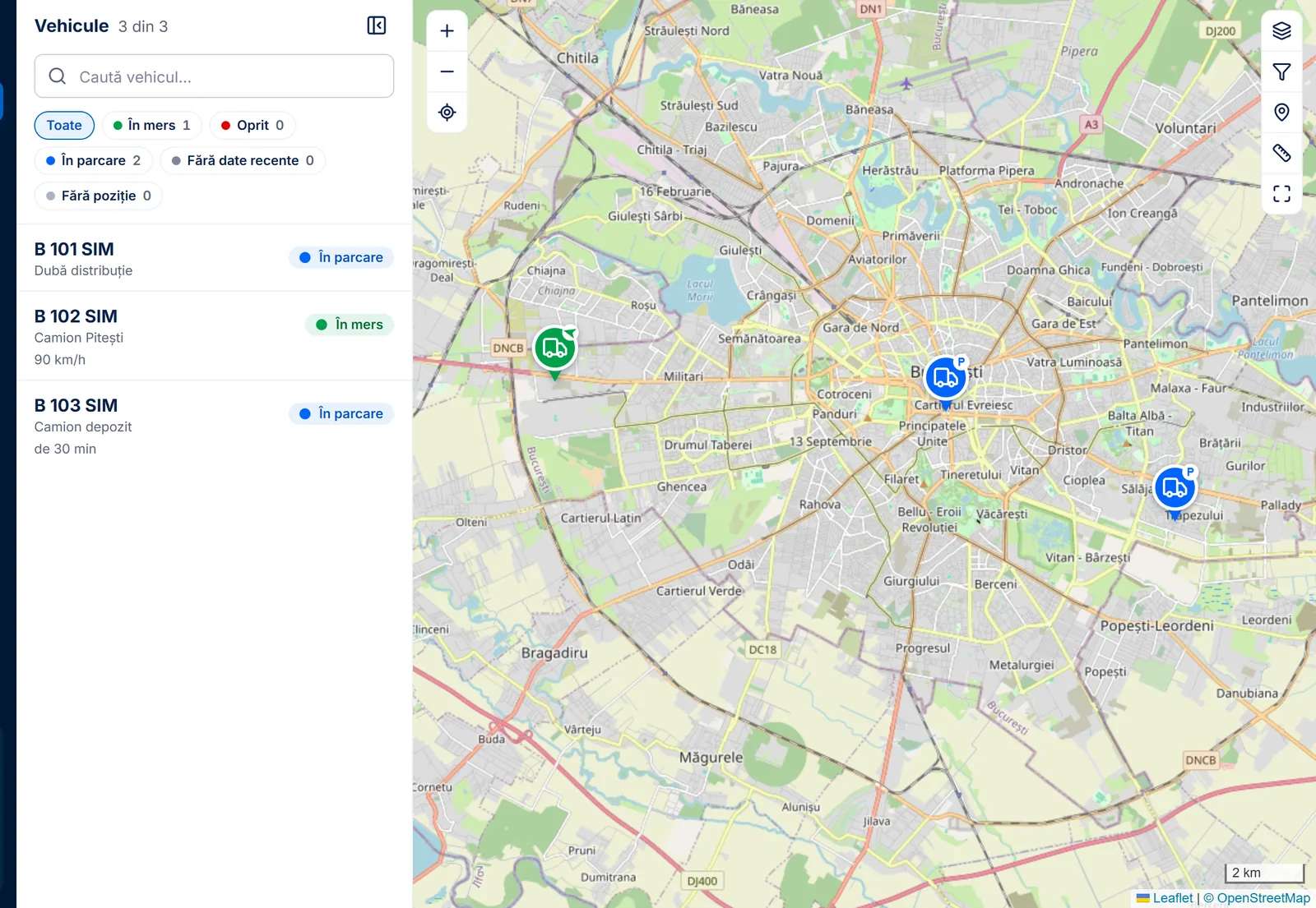
In short
- Who it is for
- Companies with vehicles, from a few vans to trucks.
- Who uses it
- The company administrator, dispatchers and view-only users.
- Where it runs
- In the browser, on a computer, tablet or phone, with nothing to install.
- Devices
- Teltonika FMC920 and FMC150 trackers, fitted in the vehicle.
What GPS'CU does
Every trip, replayed on the map
For any day or period, GPS'CU splits the vehicle's activity into trips and stops, with times, distance and speeds. The route can be replayed on the map, and several vehicles' routes can be seen together.
- Trips and stops, with departure, arrival and distance
- An animated replay of the route
- Up to 10 vehicles on the same map
app.gpscu.ro 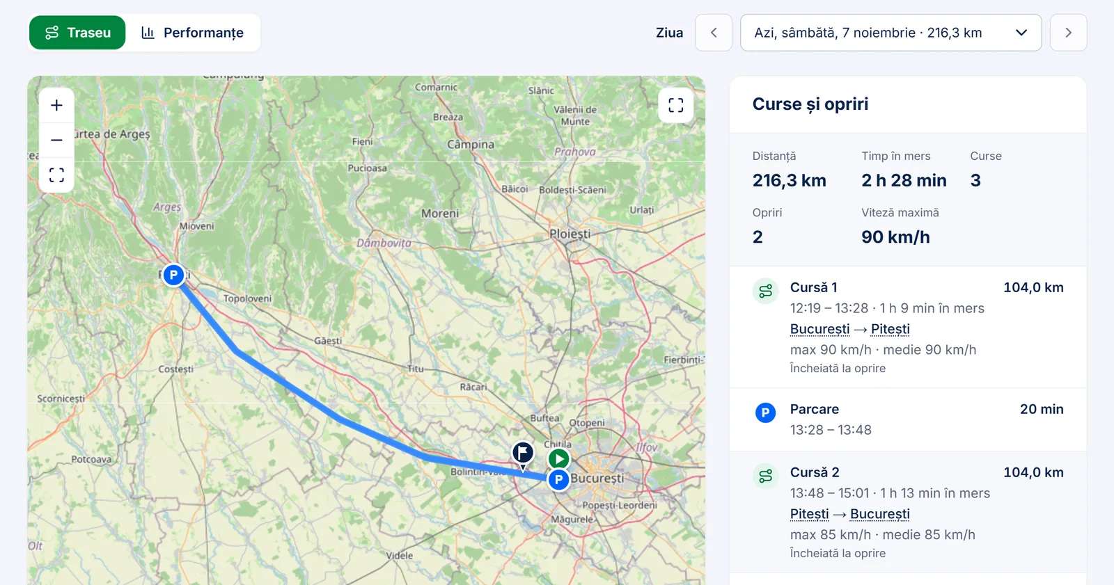
Maps: © OpenStreetMap contributors Eight reports, ready to send
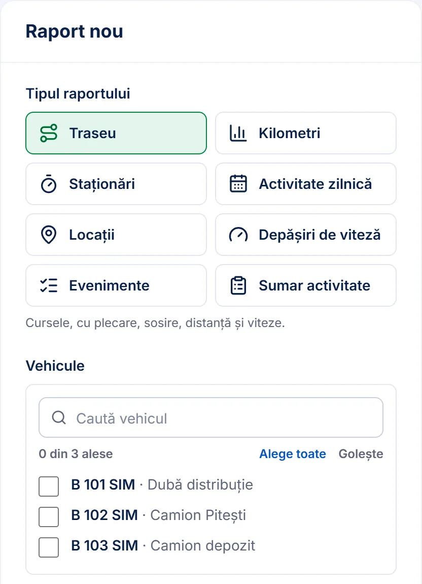
The reports cover routes, kilometres, stops, daily activity, locations, speeding, events and an activity summary. They download as PDF or Excel and can arrive by e-mail on their own, daily, weekly or monthly.
- PDF and Excel, for one vehicle or all of them
- Reports scheduled by e-mail
- Daily activity, useful for the waybill
The alerts that matter
The company chooses which alerts it gets and who gets them, in the app or by e-mail: entering and leaving zones, speed, long stops, the engine left running, unplugging or towing, lost signal and expiring documents.
- 17 kinds of alert
- Zones drawn on the map as a circle or polygon
- Each person gets only the alerts for their vehicles
app.gpscu.ro 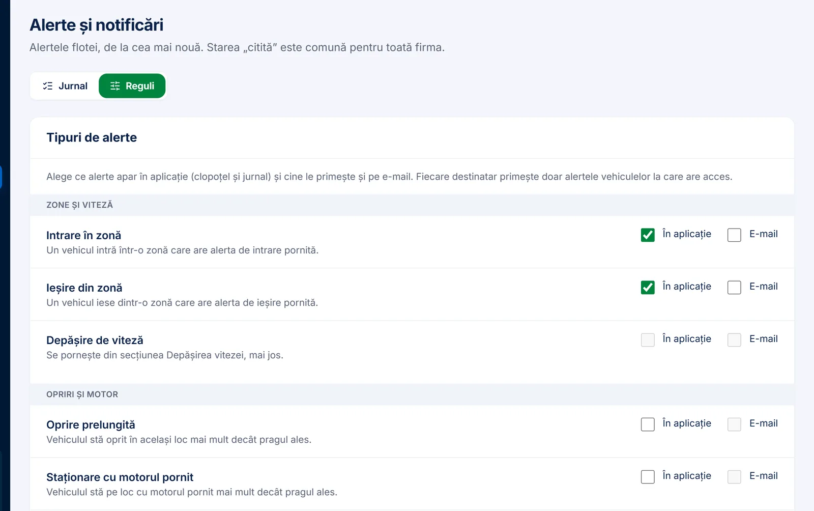
RO e-Transport, with no manual sending
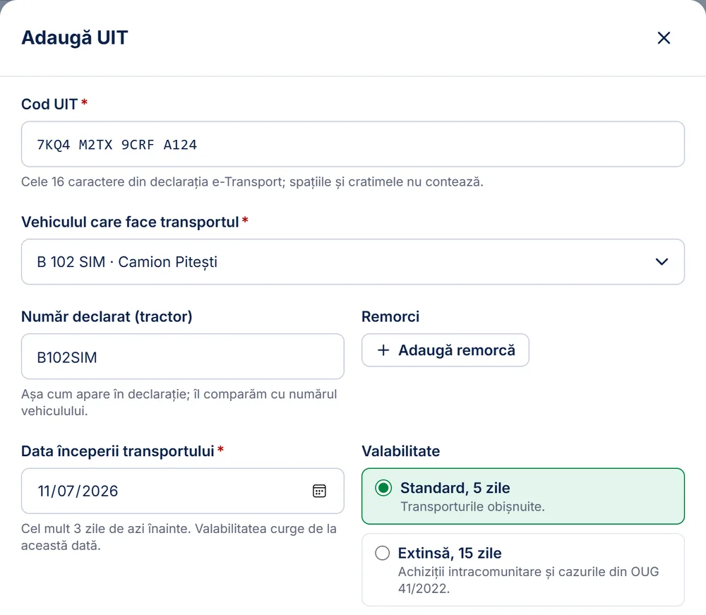
The dispatcher enters the UIT code from the declaration and picks the vehicle. While the UIT is active, GPS'CU sends the vehicle's positions to ANAF and warns if sending stops or if the declared plate does not match the vehicle.
- Several active UITs on the same vehicle
- A 5 or 15 day validity, stopped automatically
- An alert before the 4-hour deadline
Your customer sees the truck, with no account
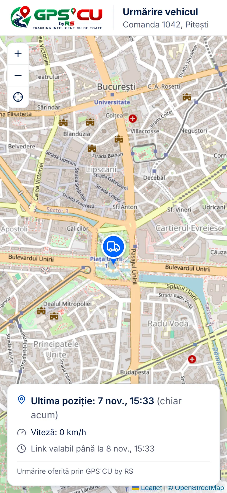
A tracking link shows a customer the vehicle's position for the length of a trip. The company chooses how long the link works, from one hour to five days, and can stop it at any time. For a set destination, the customer can also get an arrival e-mail.
- Opens on any phone, with no app
- Speed shows only if the company wants it to
- The link stops by itself when it expires
Maps: © OpenStreetMap contributors
How GPS'CU works
The tracker sends its position
The Teltonika device in the vehicle sends its position about every 30 seconds while the vehicle moves.
The platform receives it
The GPS'CU server recognises the device, reads the data and updates the map with no reload.
Works out what happened
Trips, stops, kilometres, alerts and scheduled reports come out of the positions.
Passes it on
Positions go to ANAF for active UITs, and customers see them through tracking links.
What RS built
We built GPS'CU from scratch in 2026: the server that receives data straight from the trackers, the trip and alert processing, the reports, the ANAF link for RO e-Transport and the portal companies use.
The platform also has a public API with access keys, for companies that want the data in their own software, and it sends data to EvitaAmenda. The data is stored on servers in the European Union, in Frankfurt.
We build platforms like this for other companies too. Custom software
What we built it with
- Portal
- Next.js · React · TypeScript · Leaflet · Socket.IO
- Server and data
- NestJS · Node.js · Prisma · PostgreSQL
- Infrastructure
- DigitalOcean (Frankfurt) · Docker · Caddy
- Maps
- OpenStreetMap · MapTiler
Have an idea? Let's talk.
Tell us what you want to build. We'll come back with the right questions, then a quote.